
Discover Sunderdhunga Trek, Uttarakhand – “Valley of Beautiful Stones”
Hidden deep in the Kumaon Himalayas, the Sunderdhunga Trek, Uttarakhand is one of the most scenic and least-crowded Himalayan treks. Known as the “Valley of Beautiful Stones,” Sunderdhunga Valley offers a rare blend of dramatic landscapes, ancient villages, dense forests, pristine glaciers, and spiritual sites. Unlike popular trekking routes, this trail remains largely untouched, making it ideal for trekkers seeking solitude, raw nature, and authentic mountain culture.
Located close to the Nanda Devi massif, the Sunderdhunga trek is a journey into the heart of Uttarakhand’s wilderness.
What Is Sunderdhunga Valley?
The Sunderdhunga Valley lies in the Bageshwar district of Uttarakhand, in the Kumaon region, not far from the famous Pindari Valley. In fact, the trek begins from the same starting point as the Pindari Glacier Trek, but then diverges into a quieter and more remote landscape.
The name “Sunderdhunga” literally translates to “Valley of Beautiful Stones.” According to local legend, a shepherd once discovered gold-like stones here, giving rise to the valley’s name.
The valley gained attention through classic Himalayan literature, notably Eric Shipton’s “Nanda Devi” and Jim Corbett’s “Man-Eaters of Kumaon,” which mention the region’s wilderness and mystery.
The Sunderdhunga Valley, located in the Kumaon region of Uttarakhand near Nanda Devi, is a hidden gem. I first learned about it from Eric Shipton’s ‘Nanda Devi’ and Jim Corbett’s ‘Man-Eaters of Kumaon.
Why Choose the Sunderdhunga Trek in Uttarakhand?
The Sunderdhunga Trek is perfect for trekkers who want:
-
An off-the-beaten-path Himalayan trek
-
Stunning views of snow-capped peaks and glaciers
-
Dense rhododendron and alpine forests
-
Authentic village life in Khati, Jatoli, and Kathaliya
-
A mix of adventure, culture, and spirituality
It is more challenging than the Pindari Glacier trek but far more rewarding for experienced trekkers.
Sunderdhunga Trek Overview
-
Region: Kumaon, Uttarakhand
-
Destinations: Bageshwar – Loharkhet – Khati – Jatoli – Kathaliya – Sunderdhunga
-
Trek Type: Moderate to Challenging
-
Maximum Altitude: 4,320 meters (approx.)
-
Duration: 7 Nights / 8 Days
-
Best Time to Visit: May, June, September & October
Detailed Sunderdhunga Trek Itinerary
Day 1: Bageshwar to Loharkhet
-
Start Point: Bageshwar
-
Visit the ancient Baghnath Temple, located at the confluence of the Saryu and Gomti rivers
-
Drive to Loharkhet
-
Overnight stay at Loharkhet
Day 2: Loharkhet to Khati
-
Trek Distance: ~19 km
-
The trail passes through forests and mountain villages
-
Khati is the largest village in the region
-
Enjoy views of Nandakot peaks
-
Overnight stay in Khati
Day 3: Khati to Jatoli
-
Trek Distance: ~14 km
-
Walk through thick rhododendron forests
-
Peaceful trails with river crossings
-
Overnight stay in Jatoli
Day 4: Jatoli to Kathaliya
-
Trek Distance: ~13 km
-
Trail ascends gradually through alpine forests
-
Kathaliya is the last inhabited village on the Sunderdhunga route
-
Overnight stay in Kathaliya
Day 5: Kathaliya to Sunderdhunga & Back
-
Most challenging day of the trek
-
Trek via Makoli Top (steep route) or Sukhram Cave
-
Reach the Sunderdhunga Glacier region
-
Witness dramatic views of ice fields, rocks, and towering peaks
-
Return to Kathaliya for overnight stay
Day 6: Kathaliya to Jatoli
-
Trek Distance: ~13 km
-
Descend through familiar trails
-
Duration: ~5 hours
-
Overnight stay in Jatoli
Day 7: Jatoli to Dhakuri
-
Trek Distance: ~14 km
-
Dhakuri offers panoramic Himalayan views
-
Overnight stay in Dhakuri
Day 8: Dhakuri to Loharkhet to Bageshwar
-
Trek Distance: ~14 km (downhill)
-
Drive back to Bageshwar
-
Trek concludes
How to Reach Sunderdhunga Trek Starting Point
Reaching Sunderdhunga Valley is a journey in itself.
-
Nearest Railway Station: Kathgodam
-
Nearest Airport: Pantnagar
-
From Kathgodam/Pantnagar, it’s a 6–7 hour drive to Bageshwar
Road Distances
-
Kapkot to Khati: 60 km (road)
-
Khati to Jatoli: 7 km
-
Jatoli to Kathaliya: 12 km
Sunderdhunga Valley Development & Easier Access
The Bageshwar district administration has approved major infrastructure improvements to make the Sunderdhunga Valley trek safer and more accessible.
Key Developments
-
A new pedestrian footpath connecting Sunderdhunga Valley
-
Easier access to Devi Kund and Nag Kund
-
Boost to religious tourism after the visibility of Swastik Mountain
-
Total project cost: ₹96.98 lakhs
The approval letter has been issued by the Joint Secretary, and work will begin soon under the Public Works Department.
Devi Kund & Nag Kund – Spiritual Sites in Sunderdhunga Valley
Along with adventure tourism, the valley is gaining importance as a religious tourism destination.
Walking Distances
-
Kathaliya to Bailuni Bugyal: 3 km
-
Bailuni Bugyal to Devi Kund: 5 km
-
Devi Kund to Nag Kund: 5 km (on foot)
These pristine high-altitude lakes remain snow-covered for most of the year and are surrounded by dramatic Himalayan scenery.
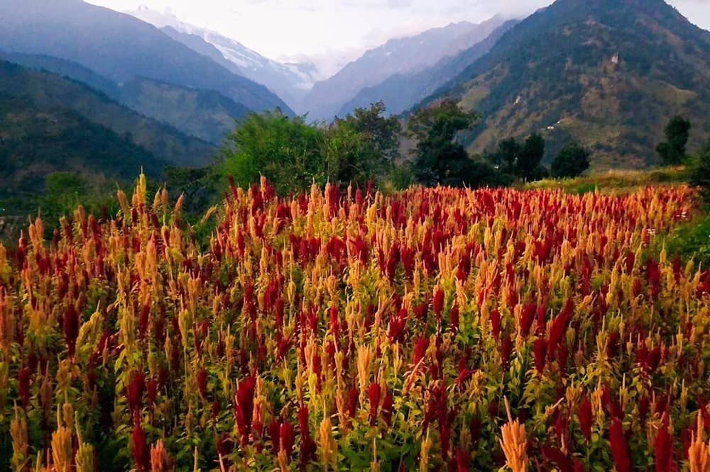
Best Time to Do the Sunderdhunga Trek
-
May–June: Clear weather, blooming alpine flowers
-
September–October: Stable weather, post-monsoon clarity
-
Avoid July–August: Heavy monsoon and landslide risk
-
Winter: Trek inaccessible due to heavy snow
Who Should Do the Sunderdhunga Trek?
Ideal for:
-
Experienced trekkers
-
Adventure seekers
-
Nature photographers
-
Travelers looking for remote Himalayan treks
Not recommended for beginners without prior high-altitude trekking experience.
Conclusion
The Sunderdhunga Trek, Uttarakhand, truly lives up to its name as the “Valley of Beautiful Stones.” From untouched forests and glacial landscapes to sacred lakes and ancient villages, this trek offers a raw and deeply rewarding Himalayan experience.
With upcoming infrastructure improvements and growing recognition, Sunderdhunga Valley is set to become one of Uttarakhand’s most important adventure and spiritual destinations—while still retaining its pristine charm.
If you’re seeking a trek that combines solitude, adventure, culture, and natural beauty, Sunderdhunga should be at the top of your list.