
🕉️ Kedarnath Trek Distance and Time: Complete Guide for Pilgrims & Trekkers
The Kedarnath trek is one of the most sacred and scenic pilgrimages in India. Set in the majestic Garhwal Himalayas, this journey blends spiritual devotion, physical endurance, and Himalayan beauty. Knowing the Kedarnath trek distance and time in advance helps you plan better and enjoy the experience safely.
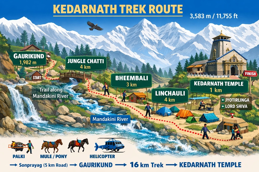
📏 Kedarnath Temple Trek Distance (Latest Update)
-
Kedarnath trek distance in km: 16 km
-
Starting point: Gaurikund
-
Ending point: Kedarnath Temple
-
Walking distance in Kedarnath: Entire 16 km is uphill
Earlier, the trek was nearly 20 km. After the 2013 Kedarnath floods, the route was redesigned, reducing the distance to 16 km.
⏱️ Kedarnath Trek Distance Time
-
Average trekking time: 6–7 hours
-
Slow pace / elderly pilgrims: 8–9 hours
-
With overnight halt: 1–2 days
Your speed depends on fitness, weather, crowd, and acclimatization.
📍 Kedarnath Trek Distance from Sonprayag
-
Sonprayag to Gaurikund: 5 km (motorable road)
-
Gaurikund to Kedarnath: 16 km (trek)
Sonprayag to Kedarnath Trek Distance
➡️ Total distance: 21 km
(5 km by road + 16 km walking)
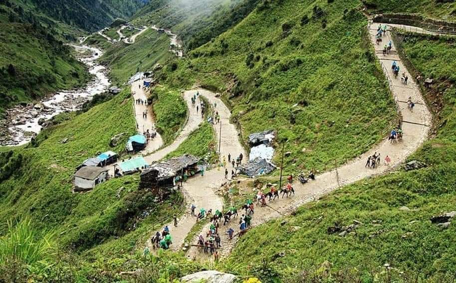
🥾 Gaurikund to Kedarnath Trek Distance (Stage-wise)
Kedarnath Trek Route – Step by Step
-
Gaurikund to Jungle Chatti – 4 km
-
Jungle Chatti to Bheembali – 3 km
-
Bheembali to Linchauli – 4 km
-
Linchauli to Kedarnath Base Camp – 4 km
-
Base Camp to Kedarnath Temple – 1 km
➡️ Total distance of Kedarnath trek: 16 km
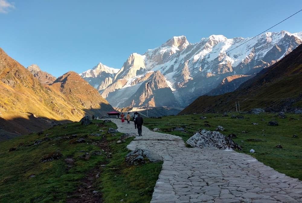
🖼️ Kedarnath Trek Route Picture (Description)
The trek runs parallel to the Mandakini River, passing:
-
Pine & rhododendron forests
-
Waterfalls and bridges
-
Mountain shelters & camps
-
Snow patches (early season)
(For safety reasons, actual trek maps should be checked locally.)
🧗 Kedarnath Trek Difficulty Level
-
Difficulty: Moderate to Difficult
-
Altitude: 3,583 meters (11,755 ft)
-
Challenges:
-
Steep inclines
-
Rocky & uneven terrain
-
Cold weather & thin air
-
Proper fitness and slow pacing make the trek manageable.
🌦️ Kedarnath Trek Best Time
Best months:
-
May to June
-
September to October
❌ Avoid:
-
July–August (monsoon) – landslides & heavy rain
-
Winter (Nov–Apr) – temple closed due to snow
🚶 Alternate Travel Options (If You Can’t Walk)
At Gaurikund, pilgrims can choose:
-
Palki (palanquin)
-
Kandi (basket carry)
-
Mule / Pony
-
Helicopter (from Phata, Sersi, Guptkashi)
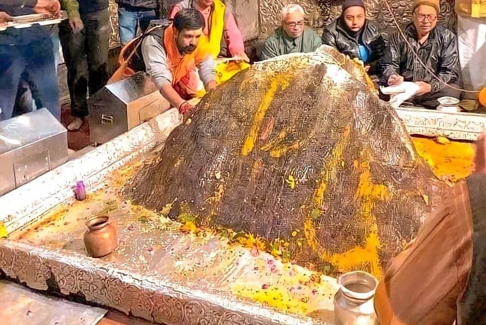
🏔️ Kedarnath Height & Location
-
Elevation: 3,583 meters
-
Region: Garhwal Himalaya
-
Temple deity: Lord Shiva
-
Significance: One of the 12 Jyotirlingas
🕊️ Kedarnath & Char Dham Yatra
Kedarnath is a vital part of the Char Dham Yatra, along with:
-
Badrinath
-
Gangotri
-
Yamunotri
🌊 Kedarnath Floods 2013 (Why Route Changed)
In June 2013, flash floods devastated Kedarnath and surrounding valleys. Since then:
-
Trek route redesigned
-
Safer paths introduced
-
Infrastructure strengthened
Today’s 16 km route is shorter and safer.
❓ Frequently Asked Questions (FAQ)
❓ Is Kedarnath trek difficult?
Yes, it is moderate to difficult, mainly due to altitude and uphill terrain.
❓ How many km trek to Kedarnath?
16 km from Gaurikund.
❓ How long is the Kedarnath trek?
Usually 6–7 hours, depending on pace and weather.
❓ Is Kedarnath trek dangerous?
Not if:
-
Weather is clear
-
You trek during permitted hours (4:00 AM – 1:30 PM)
-
You follow official routes
🧭 Other Common Distance Queries
-
Gaurikund to Kedarnath trek distance: 16 km
-
Sonprayag to Kedarnath trek distance: 21 km
-
Gangotri to Kedarnath trek distance: ~280 km (by road + trek segments)
-
Distance of Kedarnath trek: 16 km
(Note: Kedarkantha trek is a different trek and unrelated to Kedarnath.)
🏁 Conclusion
The Kedarnath trek distance and time may seem demanding, but the reward is unparalleled—divine energy, Himalayan grandeur, and a sense of achievement. With proper preparation, pacing, and respect for nature, this sacred journey becomes one of the most meaningful experiences of a lifetime.
🕉️ Walk with faith, tread with care, and let the Himalayas guide you.