Kalindi Pass Trek (Kalindi Khal / Parvat): A Complete Guide (2026)
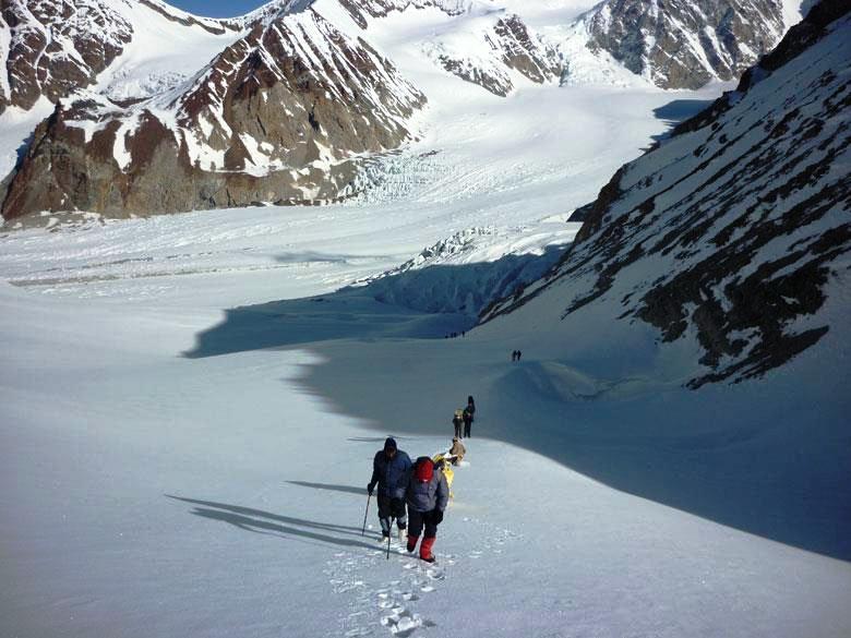
The Kalindi Pass, also known as Kalindi Khal, is one of the most extreme and technical high-altitude treks in India. Located deep in the Garhwal Himalayas of Uttarakhand, this legendary route connects two of Hinduism’s most sacred pilgrimage sites—Gangotri and Badrinath—through a wild, glaciated corridor of ice, rock, and towering Himalayan giants.
This trek is not for casual trekkers. It is a mountaineering-grade expedition, reserved for highly experienced adventurers.
Geographic Significance of Kalindi Khal
Kalindi Pass lies at the heart of the Garhwal massif, surrounded by some of India’s most iconic Himalayan peaks:
-
Mount Nanda Devi
-
Kamet
-
Trishul
-
Dunagiri
-
Shivling
-
Satopanth
The region is carved by massive glaciers, hanging icefalls, sharp ridgelines, and untouched valleys close to the ancient Tibet border.
Suggested Read – Bali Pass Trek -A Raw Adventure Experience in Garhwal Himalayas

Kalindi Pass Trek Distance & Duration
| Detail | Information |
|---|---|
| Maximum Altitude | 5,980 m |
| Total Trek Distance | ~95–105 km |
| Total Duration | 12–14 days |
| Difficulty Level | Extremely Difficult |
| Best Season | July to September |
Technical Requirements
⚠️ This trek requires full mountaineering gear:
-
Harness & ropes
-
Ice axe & crampons
-
Helmets
-
Glacier travel skills
-
High-altitude experience (6000 m class)
It is not suitable for beginners.
Kalindi Pass Trek Cost (Estimated)
Due to permits, logistics, and safety requirements, Kalindi Pass is one of the most expensive treks in India.
Approximate Cost:
-
₹1,50,000 to ₹2,50,000 per person
-
Includes:
-
Forest & expedition permits
-
High-altitude guides & porters
-
Mountaineering equipment
-
Food & camping logistics
-
Insurance & emergency planning
-
Costs vary based on group size, expedition operator, and weather window.
Why Kalindi Khal Is So Rare
-
Extremely remote & technical
-
Strict permit regulations
-
Glacier hazards & weather unpredictability
-
Requires elite-level preparation
Only a handful of expeditions attempt it each year, making it one of the rarest Himalayan routes.
Suggested Read – Bhilangana Valley – The Gateway to Khatling Glacier Trek
Kalindi Pass Trek vs Other High Passes
| Trek | Max Altitude | Difficulty |
|---|---|---|
| Kalindi Khal | 5,980 m | Extreme |
| Bali Pass | 4,950 m | Difficult |
| Borasu Pass | 5,450 m | Very Difficult |
| Rupin Pass | 4,650 m | Moderate–Difficult |
Final Thoughts
The Kalindi Pass Trek (Kalindi Khal) is not just a journey—it is a Himalayan rite of passage. Linking Gangotri to Badrinath through glaciers and sacred peaks, it represents the ultimate blend of spiritual geography and extreme adventure.
This is a trek for those who seek silence, solitude, and the raw power of the high Himalayas—where every step is earned and every view unforgettable.


