

Uttarakhand Himalayan Trekking Guide
Best 6 to 10 Day Treks in Uttarakhand Himalayas
Compare multi-day Himalayan trekking routes by distance, duration, altitude and stated difficulty. From forest trails and alpine meadows to glacier approaches, use this guide to begin planning your next Uttarakhand adventure.
Plan your Himalayan route
Discover Multi-Day Treks Across Uttarakhand
Uttarakhand offers a remarkable variety of trekking landscapes: oak and rhododendron forests, remote villages, high-altitude meadows, sacred mountain valleys and glacier country. A trek can be a short village-to-village journey or a demanding expedition that requires careful acclimatisation, experienced support and permits.
This guide brings together 16 trekking routes from the supplied route list, including Kuari Pass, Har Ki Dun, Ruinsara Tal, Pindari Glacier and Gaumukh–Nandanvan–Tapovan. Use the comparison table to shortlist options, then verify the latest route conditions, access rules, total walking distance and itinerary with a qualified local operator before booking.
Route comparison
16 Treks in Uttarakhand: Distance, Duration & Difficulty
Scroll horizontally on mobile to compare all columns.
| No. | Trek route | Distance stated | Duration stated | Altitude stated | Difficulty stated |
|---|---|---|---|---|---|
| 1 | Thailisain–Peersain–Binser–Gairsain Trek | 28 km | 6 days | 2,480 m | Normal |
| 2 | Panwali Kantha Trek | 22 km | 9 days | 3,963 m | Normal |
| 3 | Bansinarayan–Nandikund Trek | 42 km | 7 days | 5,450 m (as supplied) | Medium |
| 4 | Nanda Devi National Park Trek | 120 km | 7 days | 5,000 m | Strenuous |
| 5 | Joshimath–Painka–Kakbhushandi Tal Trek | 58 km | 6 days | 4,345 m | Strenuous |
| 6 | Roop Kund Trek | 56 km | 6 days | 5,029 m | Strenuous |
| 7 | Malari–Milam Glacier–Munsyari Trek | 124 km | 10 days | 5,377 m | Strenuous |
| 8 | Kuari Pass (Lord Curzon Trail) Trek | 93 km | 8 days | 4,262 m | Medium |
| 9 | Gaumukh–Nandanvan–Tapovan Trek | 29 km | 7 days | 4,460 m (as supplied) | Strenuous |
| 10 | Sangam Chatti–Dodi Tal–Hanuman Chatti Trek | 66 km | 6 days | 3,307 m | Medium |
| 11 | Har Ki Dun Trek | 33 km | 6 days | 3,566 m | Strenuous |
| 12 | Ruinsara Tal Trek | 41 km | 9 days | 3,566 m (as supplied) | Strenuous |
| 13 | Pindari Glacier Trek | 45 km | 8 days | 3,600 m | Strenuous |
| 14 | Kafni Glacier Trek | 45 km | 8 days | 3,800 m | Strenuous |
| 15 | Sunderdhunga Glacier Trek | 51 km | 9 days | 3,240 m (as supplied) | Strenuous |
| 16 | Milam Glacier Trek | 69 km | 6 days | 3,915 m | Strenuous |
Source note: route names, distances, durations, altitude figures and difficulty labels are transcribed from the information supplied for this page. Some figures may refer to different route segments or may need correction. Confirm each route with current local sources before publishing or selling a trek.
Choose thoughtfully
How to Choose the Right Uttarakhand Trek
The most suitable trek depends on more than the number of days. Consider altitude, daily walking hours, terrain, remoteness, weather, access permissions and the group’s previous mountain experience.
Check the altitude
Higher routes may increase the risk of altitude illness. Ask about acclimatisation, the highest sleeping altitude and the plan for symptoms or emergency evacuation.
Understand the distance
Confirm whether the stated kilometres are one-way, round-trip or the full approach-and-return route. Daily elevation gain and trail conditions also affect difficulty.
Match the challenge to your fitness
Build endurance before departure and discuss your experience honestly with the trek organiser. A label such as “medium” is not a universal standard.
Confirm permits and access
Some routes pass through protected areas or restricted zones. Check current permits, local rules, guide requirements and seasonal closures before travelling.
Plan for mountain weather
Carry layers, waterproof protection, suitable footwear and a headlamp. Weather can change quickly, even when the forecast looks favourable in town.
Use qualified local support
Choose a responsible operator with a clear itinerary, trained staff, emergency communication arrangements and transparent inclusions and exclusions.
Popular route themes
Forests, Alpine Meadows and Glacier Country
These routes offer different experiences. Treat the short descriptions below as a starting point for research, then check current trail information and access restrictions for your intended dates.
High mountain landscapes
Prepare for exposed terrain, changing weather and high-altitude conditions.
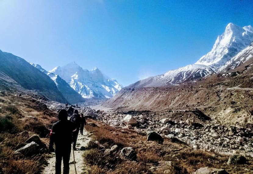
Gaumukh–Tapovan region
A demanding high-altitude route associated with the Gangotri Glacier area; permits and route conditions must be checked.
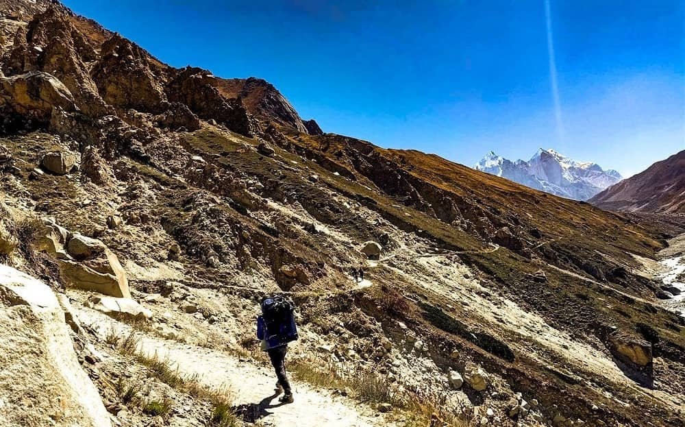
Gomukh and Gangotri
Plan carefully for the approach, altitude, weather and protected-area rules.
Before you go
Frequently Asked Questions About Trekking in Uttarakhand
Which Uttarakhand treks take around 6 to 10 days?
The supplied list includes routes such as Kuari Pass, Har Ki Dun, Pindari Glacier, Ruinsara Tal, Panwali Kantha and Gaumukh–Nandanvan–Tapovan. Actual duration depends on the itinerary, trail access, weather and the operator’s route plan.
Are the distances in the table round-trip distances?
The original information does not consistently define how distance is measured. Confirm whether each figure is one-way, trail-only or the complete return route before using it to plan a trip.
What does “normal”, “medium” or “strenuous” mean?
These are the labels supplied in the original list, not a standardised grading system. Ask for daily distance, elevation gain and loss, trail exposure, expected walking hours and highest sleeping altitude.
Do I need permits for Himalayan treks?
Permit requirements depend on the route and the current rules of the relevant authorities. Check before departure, particularly for national parks, glacier areas and other regulated zones.
What is the best time for trekking in Uttarakhand?
There is no single season suitable for every route. Conditions vary with altitude, snowfall, monsoon rainfall and local access rules. Check a route-specific seasonal guide and current local advice before choosing dates.
What should I pack for a multi-day trek?
Common essentials include broken-in trekking footwear, layered clothing, rain protection, warm insulation, a headlamp, personal medicines, sun protection, water-carrying equipment and a suitable backpack. Follow the final packing list from your trek organiser.
Can beginners do a 6 to 10 day trek?
Some multi-day routes may suit well-prepared beginners, while high-altitude and glacier routes can be demanding. Choose according to fitness, experience, acclimatisation needs and qualified local advice rather than duration alone.
Plan with local guidance
Planning a Trek in Uttarakhand?
Share your preferred dates, group size, trekking experience and the kind of landscape you want to explore. Rishikesh Day Tour can help you discuss available options and practical arrangements.